
For a year and a half, there are new rules for registration of the right to garden and country sites and houses. We tell what fraudulent schemes arose with them and how not to become a victim of fraudsters.
Photo: shutterstock / fotodom.ru
Resolution of disputes about the boundaries of land in the courts has long been commonplace, neighbors often find out who and who "slaughtered" an extra meter or fence is on whose land. However, it happens like this: the lack of information about the boundaries of the station was used by various sorts of fraudsters.

New rules
Information on the presence (or absence) information about the boundaries of land plots can be obtained from three sources:
- Public cadastral map posted on the Rosreestra portal;
- cadastral passport (extract from the State Cadastre of Real Estate);
- With the personal contact of the office of the reception of the branch of Rosreestra or MFC with a request for the provision of information included in the State Cadastre of Real Estate.
When setting up land, it is necessary to remember that it is possible to do this through an electronic portal. The owner will have to register on the portal to order service, pay the fee and to be the appointed day in the office or Rosreestra MFC (or be able, by paying this additional service, to receive electronic documents by mail or courier).
Note that the list of documents necessary for registration may vary depending on the type of property, the composition of the object of ownership, the region in which it is located.
Please note: the impossibility of identifying the applicant's personality is the basis for refusing to accept the application. Thus, the registration procedure protects the landowners from fraudulent attempts to register someone else's plot on their name.
In addition, in order not to "lose" when setting to the state cadastral accounting, not one of the owners of the plots, a single application for all newly educated areas is presented to the registration authority. At the same time, all participants in total property are treated with statements - in the event that the original land plot was owned by several persons.

Photo: shutterstock / fotodom.ru

Frameters became easier to live?
Extract from EGRN, as well as the certificate of ownership, is assigned to the stamp seal and signed by the state registrar, and an electronic digital signature is affixed on the electronic discharge. These means allow reliably to protect the statement and guarantee its authenticity.
The only confirmation of the registered ownership of the property is to have a record of this in the Unified State Register of Real Estate. Therefore, it is necessary to remember that the document issued after the registration actions reflects information relevant only at the time of their introduction to the registry.
However, over time, the property may change the owner, and the object itself could undergo changes, arrest could be imposed on it. That is why the loophole remains for dishonest sellers for the hand. None in the statement, nor in the evidence of the old sample change is not reflected - if only this document is not received immediately before conclusion of the transaction. Of course, such a deal will not be allowed to register specialists of Rosreestra, but it does not prevent fraudsters to receive, for example, an advance and hide with money in an unknown direction.
It is possible to get an extract (in contrast to the certificate), it is quite quickly, its term of its action is not limited.

Fraudulent schemes
Moving against will
The following scheme of the earth fraud is very popular: the site (most often located on an inequate territory) can "move" by the will of the violators of the law for tens of kilometers. In this case, the buyer shows a plot in a picturesque place, often with gas supplied and water supply. And the price of the site is suitable, just not a purchase, but the transaction of the century! However, after the transaction, it may be that the site is not at all on the place, which was originally shown, and a few kilometers from him.Registering errors in the location of the borders of the plots, if the rejection of the area on the basis of the error correction will not be more than 5%, the State Regulators are entitled to fulfill independently, without the consent of the copyright holders, after 6 months from the day notice.
Double sale
Fraudsters can also try to sell the property several times. In this case, when concluding repeated transactions, fraudsters will try to take advantage of duplicate contracts and certificates of registration of ownership. Of course, for the successful completion of such a scam, the scamuses should be support from officials.
This fraudulent scheme is possible exclusively because some property owners for various reasons are in no hurry with the design of the transaction and registration of ownership.
We remind you that the owner of the property will be recognized by the one who was the first to register with the ownership.

Owliness of cadastral value
The seller can call the buyer the cost of a plot that is overestimated towards cadastral. To a potential buyer believed called him the sum, fraudsters use the documents that display the wrong coordinates of the object, its boundaries, survey results (geological and topographical). It happens that the cost of the site increases almost half of this price. The calculation in this case is made that the buyer will not immediately perform the measurements of the site and check the documents.
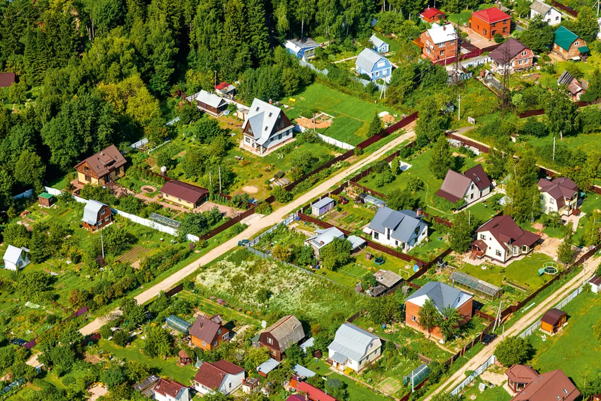
Photo: shutterstock / fotodom.ru
Hidden communications
The cost of the site will be lower if there are hidden communications under it under it. However, the seller is unprofitable - the construction of the house at such a plot is impossible.
Buyer in this case, placing false documents topographic and geological survey object from which it appears that the underground gas or electricity is not available (or is held at a considerable distance from the site).
The complexity of the situation lies not only in the fact that the buyer does not realize that subsequently the Earth will be unsuitable for construction. If it turns out that there are hidden underground communications on the site, its new owner is fined and oblige to transfer communications at their own expense.

Owner unknown
The territory, the ownership of which was not documented (or determined only on the basis of the so-called legal customs), while there is still on the map of our country. By default, such incidents are considered belonging to local governments.
In order to declare his claims to the site, it is necessary to have a document proving the right to real estate. In order for scam to take place, it is necessary that the address of the site does not indicate in such a certificate, but there was a square. And, of course, need a keen cadastral engineer who perform surveying and issue a document in which the lot number and the area will remain the same, but will be given a different address and anchor point coordinates.

Photo: shutterstock / fotodom.ru
Access to the base
With access to the database cadastral engineers can find out which land on the territory of a certain garden of the partnership are unused, which means that you can draw on them false documents and to sell.From the same bases you can get information about which areas are not privatized. Scammers change the boundaries of such sites, while they join the empty lands.
The second version of the same scheme is that unclean engineers can change the boundaries of the site in such a way as to take it beyond the boundaries of the garden partnership. It may be relevant for those partnerships that bordered with rural settlements. The benefit of fraudsters is to sell the area to residents of the village wishing to zoom in the area.
The other side of the problem is that in all documents, law-abiding owners will be the invaders of the Earth. In this case, it is possible to restore the situation only in court. Some landowners will prefer to get rid of the problem property, sales at a low price.
How to protect against fraudsters
Not always, we can resist fraudsters, but there are some rules that will help real estate owners protect themselves, as well as standard behavior algorithms in disturbing situations.
First, it is necessary to carefully store all documents related to the object of real estate. According to the new rules, individual parts of the Unified State Register of Real Estate, Cadastral Maps and Document Accounting Books are conducted in electronic form. The registry themselves are still stored in electronic form, and on paper.
Please note: the issuance of certificates of state registration of ownership of paper is not provided for, and information on registration of rights will be confirmed by the discharge from EGRN. This means that the date of receipt of the discharge in the preparation of any operations should be as much as possible.
Secondly, each landowner is advisable to make sure that the boundaries of its area specified in the documentation. It is necessary to understand that only the rights to land are preserved, which were enshrined by previously issued documents. Therefore, due to the change in the rules of the partitions, the design of cadastral documents is necessary in accordance with the new rules.
Thirdly, when making a deal, it is necessary to hold a special examination of the documentation with lawyers. Especially carefully consider the cases when the transaction is performed in two stages: First, the agreement on intentions is concluded, and only then the main part of the transaction is made.
Fourth, insist on the fact that you yourself choose a notary for making a deal, you should not agree to the seller's candidacy, especially if the conclusion of the transaction is exactly this notary to you impose particularly persistently.
By the way, the buyer can refer to the notary for advice to a meeting with the seller. Notary will explain how the transaction will be taken.
Experts say that many fraud schemes with the ground may well be revealed before the conclusion of the preliminary contract, if the buyers will bargain on all the rules, in the presence and with the assistance of an experienced lawyer.
In accordance with the new rules of cadastral registration, a copy of the boundary plan, technical plan and other documents, on the basis of which are included in the Unified State Register of real estate, can get only the rights holders or their representatives.

Photo: shutterstock / fotodom.ru

Dates of paperwork
The transition to the electronic method of registration and interaction is predetermined that the interstitial plans and survey acts will be carried out by cadastral engineers in electronic form. According to the new rules, the documents in paper format are issued to the applicant only when this is provided for by the contract.Rosreestra specialists will inform the applicant about all the actions by email and SMS.
Please note that from January 1, 2018 is impossible to make a deal with the land, whose boundaries are not established in accordance with the law, so all owners of the earth need to attend to obtain the relevant documents.
The timing of the passage of documents in Rosreestra is:
- Seven working days - for state registration of rights;
- five working days - for cadastral accounting;
- Ten working days - for the procedure for simultaneous registration of rights and cadastral accounting;
- Three working days - registration of a notarized deal, ownership on the basis of a certificate of inheritance.
- One working day - when submitting documents in electronic form.
Please note: if the documents are transmitted via MFC, all times need to be increased for two days.
Previously the controversial issues related to the authenticity of the signatures in the act of coordination of boundaries, the presence of the agreed borders, correct publication of data on borders could be checked independently - but now it is necessary to go to court.
Cadastral map
Public cadastral card, which Rosreestrom leads from 2010, will help learn not only the cadastral number of the property, but also its status; Land category and the type of permitted use; assigned address; Cadastral quarter, district and district district; The area was put on and its cadastral value; date of registration. In addition, on the map you can find information on what cadastral engineer worked with a plot.
Thus, a public card can help in selection of initial information about the object that you intend to purchase or rent.